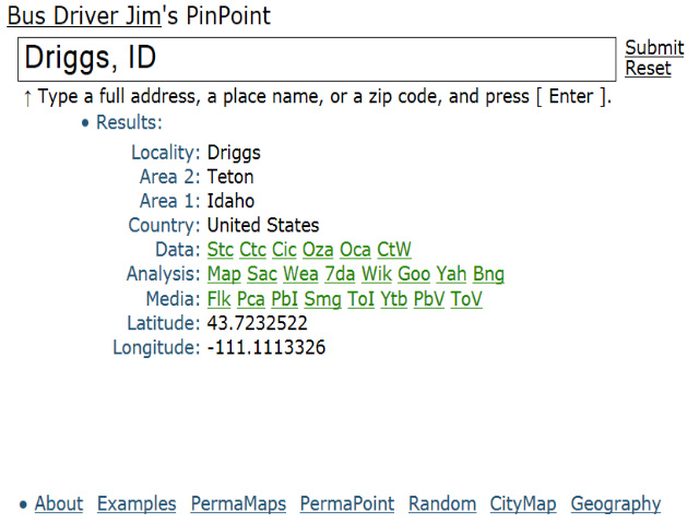
I’ve been putting a lot of code time into my new PinPoint app. Right now the new data functions consist of three character codes, just hover over them for a description.
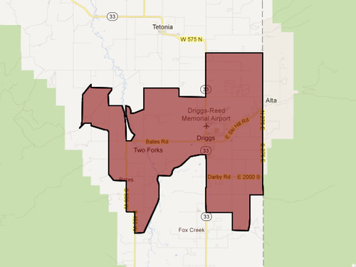
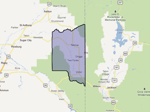
I’ve also written a new program that does two cool things, quickly. Pass it a zip code and it will display the polygon for the zip, or for the county where the zip code resides. For example, here’s the Driggs zip code polygon: 83422, and here’s Teton County’s polygon.
Hint: Click on the zip polygon for more information about that zip code. These polygons are available for all U.S. cities via PinPoint under the Oza and Oca functions.
Credits: Polyline data provided by my old friends over at PropertyMaps.com.