Ahhh, the things I find interesting that other people might not… I put my new Bing Maps V8 program into Aerial mode at the U.S. level, turned off labels, and then turned on Streetside view. The “blue” areas represent coverage.
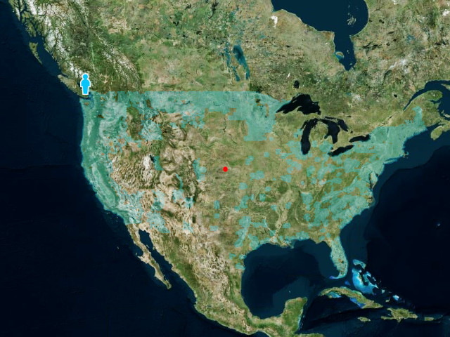
It clearly illustrates that Microsoft has a lot of work remaining to photographically map the entire United States. They’re obviously playing catch-up to Google Street View, but the image quality is much better! It also appears that the focus is the U.S. while Google is mapping the Earth and beyond.
I wonder if Microsoft is hiring people to drive the camera trucks this summer?