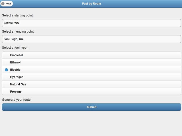
My latest program is coming along great. It’s called Fuel By Route and it’s function is to plot a route between two U.S. addresses and show you the alternative fuel stations along that route. It’s a pretty sweet mashup!
I use Google Map Services to determine all the points along the route and then pass those points to the U.S. government’s National Renewable Energy Laboratory API which returns all of the fuel stations along that route, which I then plot on the map. Whew!
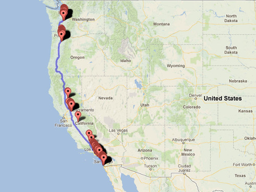
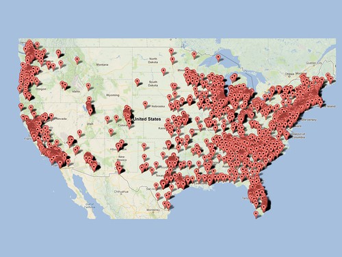
This is a separate project in which I show all of the electric charging stations in the U.S. You can see that the West Coast has a lot of locations, compared to the available stations along I-5.
The data pretty much speaks for itself. The environmental wackos keep telling us the era of the electric car has arrived, but don’t even think about a cross country road trip :-)
btw: Clicking on the program image will launch it and clicking the maps will open them up. Try the program and zoom the maps!
I guess it’s a good idea not to take an electric car cross country.
How about being towed behind a motor home? If you could figure out how to charge it while both vehicles are moving you could drive it around after you park the big rig for the night!
Actually, if your electric car gets plugged in at night, it will still have the charge whenever you arrive at the next RV park. Only problem is charging at the RV park would be the slow 110v charger and you wouldn’t be able to completely charge your batteries to full capacity. But maybe enough to drive around town and back.
Can’t believe how many charging stations there are back east!
Good point. A kinetic energy to 220v charger would be a great invention though, if it doesn’t already exist.